PUJEHUN DISTRICT
Pujehun District is in the Southern Province and it borders the Atlantic Ocean in the southwest, the Republic of Liberia to the southeast, Kenema District to the northeast, Bo District to the north and Bonthe District to the west.
The district headquarter town is Pujehun.
Councils: Pujehun district has one council and is headed by a Chairperson and assisted by a deputy chair. The District has 23 wards ranging from Ward 349 to 371 and each ward is led by a councillor.
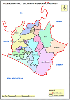
Chiefdoms: There are 12 chiefdoms in Pujehun administered by Paramount chiefs as follows: Barri; Gallines Perri; Kpaka; Kpanga Kagonde; Makpele; Malen; Mano Sakrim; Panga Krim; Peje; Soro Gbema; Sowa; Yekomo Kpukumu Krim.
Constituencies: Pujehun District has 6 constituencies starting from 099 to 104
Ethnicity: The Mende are the largest ethnic group in Pujehun district and the minority ethnic groups are Fullah, Kissi, Temne and Sherbro.
Economic Activities: Diamond mining is a major economic activity in the district. Agricultural production of cassava, coffee, and cacao are also common in the district.
Education: Pujehun District has 349 Schools; 27 Pre-primary Schools; 287 Primary Schools 26 Junior Secondary Schools and 9 Senior Secondary Schools.
Population:
Name |
Status |
Population
Census
2004 |
Population
Census
2015 |
Population
census
2021 |
Pujehun |
District |
228,392 |
346,461 |
429,574 |
PUJEHUN DISTRICT MAP SHOWING CHIEFDOM BOUNDARIES
COUNCIL HEAD |
Foday Kandeh Rogers Senior
Chairperson
Pujehun District Council
Chief Administrator:
+23279886858
|
|