|
 |
WESTERN AREA RURAL DISTRICT
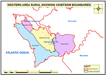
The Western Area Rural District is located around the peninsula in the Western Area of Sierra Leone. The district headquarter town is Waterloo. The district borders with Western Area Urban District on the east and west; Port Loko District to the north; and the Atlantic Ocean to the south and east.
Council: The Western Area Rural District Council (WARD C) is headed by a Council Chairman and has 27 wards ranging from Ward 372 to 398. Each Ward is represented by a Councillor in 27 ward committees.
Constituencies: Western Area Rural District has 10 constituencies ranging from Constituency 104 to 113.
Ethnicity: The Western Area Rural District is one of the most ethnically diverse districts with no single ethnic group accounting for more than 25% of the population in the District. The indigenes of the district are Krio and Sherbro.
Economic Activities: fisheries, livestock, vegetable gardens, and lumbering are the main economic activities in the Western Area Rural District.
Big and Small Towns: The district is home to several medium size and small towns which include: Waterloo, Newton, Benguema, Tombo, Leicester, Regent, Bureh Town, Jui, Grafton, York, Adonkia, Lakka, Tokeh, Sussex, Bathurst, Baw Baw, Gloucester, Kent, Kerry Town, Kebbie Town and Rokel.
Education: Western Area Rural District has 1,046 schools; 274 Pre-primary Schools, 469 Primary schools, 218 Junior Secondary schools, and 85 Senior Secondary schools.
Population:
Name |
Status |
Population
Census
2004 |
Population
Census
2015 |
Population
census
2021 |
Western Area Rural |
District |
174,249 |
444,270 |
662,056 |
WESTERN AREA RURAL MAP SHOWING CHIEFDOM BOUNDARIES
COUNCIL HEAD |
Kasho Holland Cole
Chairperson
Western Area Rural District Council
Chief Administrator:
+23276963434
|
|